by Wisconsin Wetlands Association | May 17, 2019 | Flood Resilience, News, Policy Program Updates
…Anderson, Jonathon Brostoff, Jodi Emerson, Amy Loudenbeck, Greta Neubauer, Nick Milroy, Tod Ohnstad, Romaine Quinn, Tim Ramthun, Mark Spreitzer, Ken Skowronski, Ron Tusler, and Nancy Vander Meer. Related Content How…
by Wisconsin Wetlands Association | May 11, 2023 | For communities, News, Policy Program Updates
…increase cost-share eligibility for stream and wetland (e.g., hydrologic) restoration practices. Meanwhile, in April, we hosted the second in a series of trainings designed to increase the capacity of DATCP’s…
by Wisconsin Wetlands Association | Apr 9, 2020 | News, Policy Program Updates
…and secure funding for other partnerships. Secure a state budget appropriation for wetland flood storage demonstration projects Status: AB 266/SB 252, which provides $150,000 for wetland flood storage demonstration projects…
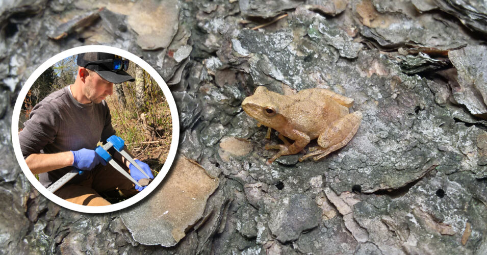
by Wisconsin Wetlands Association | May 1, 2023 | For landowners, News, Wetland Coffee Break
…the conservation of amphibians, reptiles, and bats. Related content The frog chorus in Wisconsin’s wetlands Learn about frog habitat, reproduction, community connections, and more. Identifying frogs and toads by their…
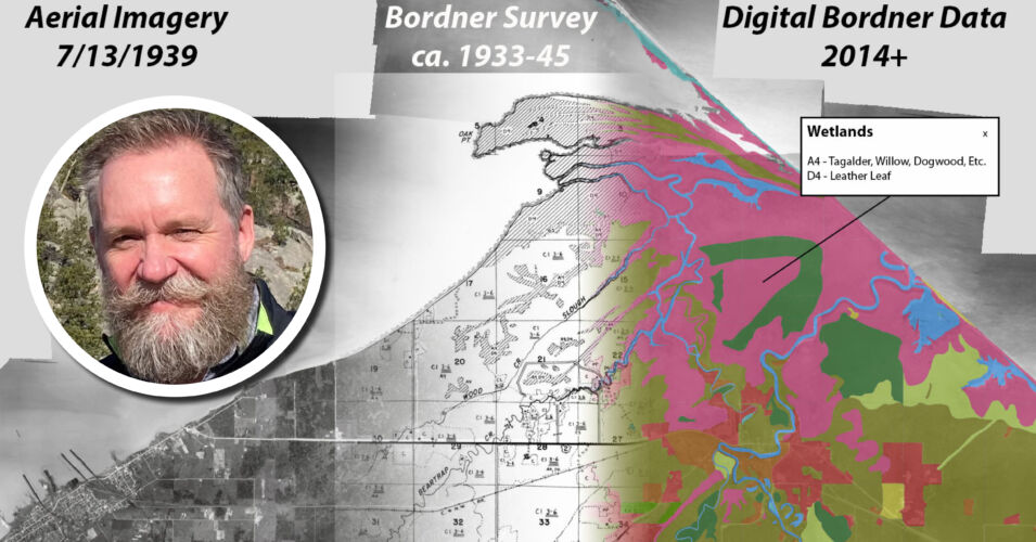
by Wisconsin Wetlands Association | May 26, 2023 | For communities, For landowners, News, Wetland Coffee Break
…https://www.usgs.gov/faqs/where-can-i-find-topographic-map-symbol-sheet GLO survey notes and maps: https://digicoll.library.wisc.edu/SurveyNotes/ Bordner scanned maps: https://search.library.wisc.edu/digital/AWILandInv Bordner digital data: https://maps.sco.wisc.edu/BordnerCoastal/about/ WGNHS: https://home.wgnhs.wisc.edu/ Robinson Map Library: https://geography.wisc.edu/maplibrary/ Geodata@Wisconsin: https://geodata.wisc.edu/ AGS Library: https://uwm.edu/libraries/agsl/ Historical Society maps: https://www.wisconsinhistory.org/Records/Article/CS15301…