Resources for wetland landowners
My Healthy Wetland handbook
Want to learn more about how to learn about and care for your wetland? We’ve put together a handbook just for wetland landowners.
The latest landowner news
Check out our blog for the latest updates about wetlands in Wisconsin, including news and helpful information for wetland landowners.
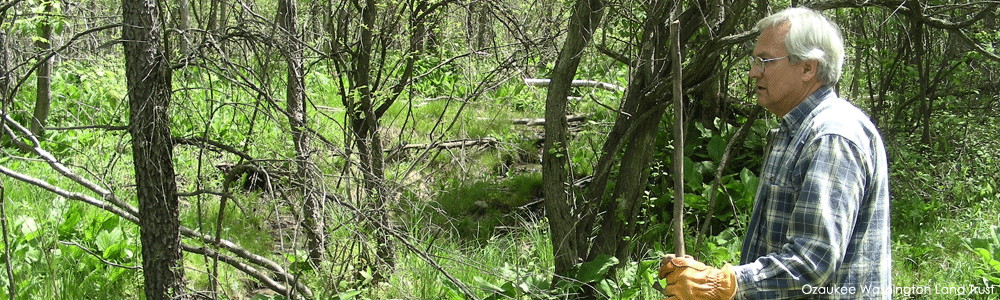
The help you need
Whether you’re looking for permanent protection options or funding for a restoration project, there’s a program, publication, or group in Wisconsin that can help. The tabs below connect you with the many resources out there for you. Click on each tab for the information you need.
Aerial photos are a great way to learn about your wetland. Below are some resources to help you connect with aerial photos and other maps of your wetland.
A key piece of information you’ll need to be able to find maps for your land is the township, range, and section of your property. You can find the township, range, and section information on your property tax bill or property deed, plat maps from your county clerk, U.S. Geological Survey topographic maps (available by calling USGS at 1-800-872-6277), maps such as the ones in the Wisconsin Atlas & Gazetteer, and county highway department maps.
Paper maps
Your County Office – Most county offices can connect you with maps of your property. Look for the Land Conservation or Planning Department within your county government. Find your local office.
NRCS – Your local office of the USDA-Natural Resources Conservation Service may be able to help you with aerial photos and soils maps for your wetland. Find your local service center.
Your local land trust – Many land trusts have access to aerial photos and other maps and can also connect you with other resources. Find a land trust near you.
Online maps
Google Earth – This free program can be downloaded to your computer and provide you an aerial view of your property. Enter your address or area of interest and zoom in. Google Earth also has recent historic aerial photos. Get Google Earth.
A useful tool to add to Google Earth is an overlay of the Township, Range, and Section. Find and download that layer on EarthPoint. Make sure you have already downloaded and opened Google Earth on your computer before opening the downloaded file. Then, in Google Earth, click on View, then “Overview Map” to turn on the TRS layer.
Your county’s website – Most county governments in Wisconsin have developed public, interactive web mapping sites with aerial photos. Ease of use and available information varies. Find your local office.
Wisconsin State Cartographer’s Office – This office is your resource for mapping and geographic information in Wisconsin. Use their Historic Aerial Image Finder to locate Wisconsin’s earliest aerial photos (1937-41).
Other resources for the curious
Wisconsin DNR’s Surface Water Data Viewer –This site can provide you with a variety of information about any piece of land in Wisconsin. Of most interest to wetland landowners will be the “Wetlands & Soils” data layer, which shows wetlands mapped as part of the Wisconsin Wetland Inventory, Wetland Indicators (wetland soil types), and Potentially Restorable Wetlands. Challenging to navigate if you’re not familiar with GIS (geographic information systems). View the surface water data viewer.
Web Soil Survey – The Web Soil Survey provides soil data and information produced by the National Cooperative Soil Survey. It is operated by the USDA Natural Resources Conservation Service. View the Web Soil Survey.
1830s Land Office Surveys – The historic Government Land Office (GLO) survey and notes for Wisconsin are available online. These surveys were completed in mid-1800s. The site includes the scans of the actual field journals written by the surveyors. Original plat maps and field sketch maps are also available. Be sure to read the “Land Survey Information” tab before you begin. View the Land Office surveys.
Historic plats and atlases – The Wisconsin Public Land Survey Records are a portal to lots of interesting Wisconsin history. For example, historic plat maps and atlases are available for some counties—you can find out who owned and cared for your land prior to you. You can also locate old towns, roads, and buildings. Reading these documents could help to put your wetland and its management in a historical context. Find historic information about your property.
The Bordner Survey – This detailed land inventory of Wisconsin was completed in the 1930s and 40s. The effort was led by John Bordner and is thus commonly referred to as the Bordner Survey. Technically, the survey was called the Wisconsin Land Economic Inventory. Learn more about the Bordner Survey. Find scans of maps from this survey for your area (use the search bar at the top to find your Township).
Wetlands by Design – This map-based tool allows communities and decision-makers to better identify the wetland protection and restoration opportunities to best address the wetland-related conservation concerns in their watershed, such as flood abatement and water quality. With this information, communities can find the conservation opportunities most likely to provide the ‘biggest bang for the buck’ to meet their community needs. Learn more about the tool. Access the online tool.
Looking for technical assistance with your wetland? Many groups can help with your wetland questions and projects. Start with the appropriate groups and programs listed below and ask these people who else they know who can help you.
County Land and Water Conservation Departments – County land and water conservation departments are the primary local delivery system of natural resource programs in Wisconsin. These departments understand local land and water resource problems and solutions and are an excellent source for conservation assistance and planning. They provide educational, technical, financial, and conservation planning assistance to help land users and communities control soil erosion, manage natural communities and wildlife, and protect lakes, streams, wetlands, and groundwater. Find your local contact.
Land Trusts – A land trust or conservancy is a nonprofit organization that helps private landowners ensure that the natural aspects of their land that they value—and have worked hard to protect and improve—are protected forever, preserving their legacy. Wisconsin has land trusts throughout the state. Find your local land trust.
Farm Bill Biologists – Farm Bill Biologists assist landowners in designing, developing, and funding habitat improvements on private lands. They possess the knowledge of federal, state, and local programs to assist landowners in finding the right program to meet their personal habitat and land use goals. Farm Bill Biologists are located in regional USDA service centers. Find your local Farm Bill Biologist.
USDA – Natural Resources Conservation Service – The NRCS is the primary federal agency authorized to work with private landowners to help protect natural resources through technical assistance and implementation of Farm Bill programs. NRCS works through a voluntary, incentive-based approach for conservation of soil, water, and related resources. Find your local NRCS office.
USFWS Partners for Fish & Wildlife Program – The Partners for Fish & Wildlife Program is a statewide, results-oriented conservation program. Wildlife biologists work with private landowners, offering technical and financial assistance to improve their lands for fish and wildlife. Program biologists work within the needs and desires of private landowners to identify, design, and implement projects that restore upland, wetland, and riparian habitat. Learn more about the Partners Program.
Wisconsin Waterfowl Association – The nonprofit Wisconsin Waterfowl Association is dedicated to the conservation of Wisconsin’s waterfowl and wetland resources. They work closely with landowners to facilitate restoration, enhancement, and management of wetlands and associated uplands from an ecological perspective. They accept project applications and raise funds to cost-share wetland conservation projects throughout Wisconsin. They also work with federal and state wildlife agencies on Wisconsin wetland and waterfowl issues. Learn more about Wisconsin Waterfowl Association.
Looking for information and advice on controlling invasive species on your property? Many groups in Wisconsin and beyond are working to identify the best techniques to prevent, control, and manage invasive species, particularly invasive plants.
Online resources
Midwest Invasive Plant Network – MIPN hosts an Invasive Plant Control Database. You choose the plant of interest, and this database will identify and display the most effective control techniques. You can also view publications for more information.
Invasive Plants Association of Wisconsin – IPAW is a statewide resource for information on topics such as early detection and rapid response techniques for invasive plants. IPAW can also help you identify your local Cooperative Invasive Species Management Area group (such as the Southeastern Wisconsin Invasive Species Consortium and Door County Invasive Species Team), which can help in response to invasive species issues on a more local level.
University of Wisconsin Weed Science – This group is a reliable source for information on invasive species. You can browse their website for helpful tools, including videos and weed identification tips.
Wisconsin Department of Natural Resources – WDNR provides general information about control methods as well as links to additional information, including common wetland invasive species.
Great Lakes Phragmites Collaborative – This group hosts up-to-date information about the invasive plant Phragmites (giant reed grass), including informative recordings of past webinars that may be of interest to landowners.
Publications
A Field Guide to Invasive Plants in Wisconsin by Wisconsin Department of Natural Resources
Invasive Plants of the Upper Midwest by Elizabeth Czarapata
Reed Canarygrass (Phalaris arundinacea L.): A Comprehensive Literature Review (Indexed Literature Compendium, first edition, 2024 by Craig Annen
Reed Canary Grass (Phalaris arundinacea) Management Guide: Recommendations for Landowners and Restoration Professionals by the Wisconsin Reed Canary Grass Management Working Group
A good field guide helps you learn the plants and animals that call your wetland home. The list below will get you started with your search for printed publications. Many areas have specialized local field guides, so ask at your local bookstore, library, or nature center. Many field guides are also now available as apps for your smartphone, tablet, or computer.
Natural community guides
- Wisconsin’s Wetlands: A Guide by Wisconsin Wetlands Association
- Wisconsin’s Natural Communities by Randy Hoffman
Plant guides
- Aquatic Plants of the Upper Midwest by Paul M. Skawinski
- Field Guide to Wisconsin Sedgesby Andrew Hipp
- Newcomb’s Wildflower Guide by Lawrence Newcomb
- Trees of Wisconsin Field Guide by Stan Tekeila
- Wetland plants and plant communities of Minnesota and Wisconsin by Steve Eggers and Don Reed (most recent edition is only available online)
- Wildflowers and Other Plants of Iowa Wetlands by Sylvan T. Runkel and Dean M. Roosa
- Wildflowers of Wisconsin and the Great Lakes Region by Merel Black and Emmet Judziewicz
Bird Guides
- Birds of Wisconsin Field Guide by Stan Tekiela
- Peterson Field Guide to Birds of Eastern and Central North America by Roger Tory Peterson
- The Sibley Field Guide to Birds of Eastern North America (2nd Edition) by David Allen Sibley
- Wisconsin Birds: A Seasonal and Geographic Guide by Stanely A. Temple, John R. Cary, and Robert Rolley
Mammal guides
- A Field Guide to the Mammals of North America by Fiona Reid
- Handbook of Mammals of the North-Central States by J. Knox Jones, Jr., and Elmer C. Birney
- Mammals of Wisconsin Field Guide by Stan Tekiela
- Peterson Field Guide to Animal Tracks by Olaus J. Murie and Mark Elbroch
Fish guides
- Fish of Wisconsin Field Guide by Dave Bosanko
- Peterson Field Guide to Freshwater Fishes by Lawrence M. Page and Brooks M. Burr
Herpetology guides
- Amphibians of Wisconsin by Rebecca Christoffel, Robert Hay, and Michelle Wolfgram
- Snakes of Wisconsin by Rebecca Christoffel, Robert Hay, and Lisa Ramirez
- Turtles and Lizards of Wisconsin by Rebecca Christoffel, Robert Hay, and Megan Monroe
- Field Guide to Amphibian Eggs and Larvae of the Western Great Lakes by Gary S. Casper, Ryne D. Rutherford, and Thomas G. Anton
Invertebrate guides
- Butterflies of the North Woods (2nd Edition) by Larry Weber
- Damselflies of the North Woods by Bob Dubois
- Dragonflies of the North Woods by Kurt Mead
- Dragonflies of Wisconsin by Karl and Dorothy Legler with Dave Westover, Edition 5.1
- Insects of the North Woods by Jeffrey Hahn
Technical keys
- A Great Lakes Wetland Flora by Steve W. Chadde
- A Manual of Aquatic Plants by Norman C. Fassett
- Aquatic Insects of Wisconsin: Keys to Wisconsin Genera and Notes on Biology, Habitat, Distribution, and Species by William LeRoy Hilsenhoff
A Sand County Almanac and Sketches Here and There by Aldo Leopold. A must-read publication for any landowner, particularly Wisconsin landowners.
Habitat Management Guidelines for Amphibians and Reptiles of the Midwest by Midwest Partners in Amphibian and Reptile Conservation. These habitat management guidelines use the best science available to provide guidance on the management and restoration of habitats such that amphibians, reptiles, and many other wildlife species may benefit. The guidelines are easy to understand and provide practical tips and tools for land managers and private landowners.
Wisconsin’s Wetlands: A Guide by Wisconsin Wetlands Association. This four-page, full-color guide includes a photograph and description of the twelve major wetland types found in Wisconsin. This is a good starting document when you are trying to determine what type of wetland you may have on your land.
Wetland Restoration Handbook for Wisconsin Landowners by Alice L. Thompson and Charles S. Luthin. This award-winning handbook was written to encourage the responsible and effective restoration of wetland habitats. It covers topics including assessing and planning restoration, invasive species management, wetland regulations, and post-restoration management. It also provides useful literature and web resources. Available as a spiral-bound printed book or as a downloadable PDF.
What Does it Cost to Own A Wetland: A Guide to Property Tax Assessments on Wetlands and Other Privately Owned Conservation Lands in Wisconsin (A Landowner’s Guide) by Wisconsin Wetlands Association. This guide helps landowners anticipate the property tax consequences of wetland restoration decisions and to ensure that the wetlands they currently own have been properly assessed and taxed. The guide also helps natural resource professionals answer landowner questions about the tax implications of wetland restoration and other stewardship decisions.
Do you have a favorite wetland publication that you don’t see listed here? Share it with us! Email programs@wisconsinwetlands.org.
Can’t find the help you need?
We’d love to help you find the resources you need to care for your wetland. You can either leave us a note below, email us at programs@wisconsinwetlands.org, or give our office a call at (608) 250-9971.