By Eleanor Rappolee, GIS Research Analyst, ASFPM Flood Science Center. This article originally appeared in the Nov. 2022 issue of The Insider. Reprinted with permission from the Association of State Floodplain Managers.
The Wisconsin Wetlands Association and Association of State Floodplain Managers met with Marengo Watershed stakeholders on Sept. 15, 2022, to talk about the damaging impacts of flooding and erosion on infrastructure in the Ashland County, Wisconsin community in recent years. A majority of the 27 participants represented road crews, town and county officials, and other stakeholders from the region and state.
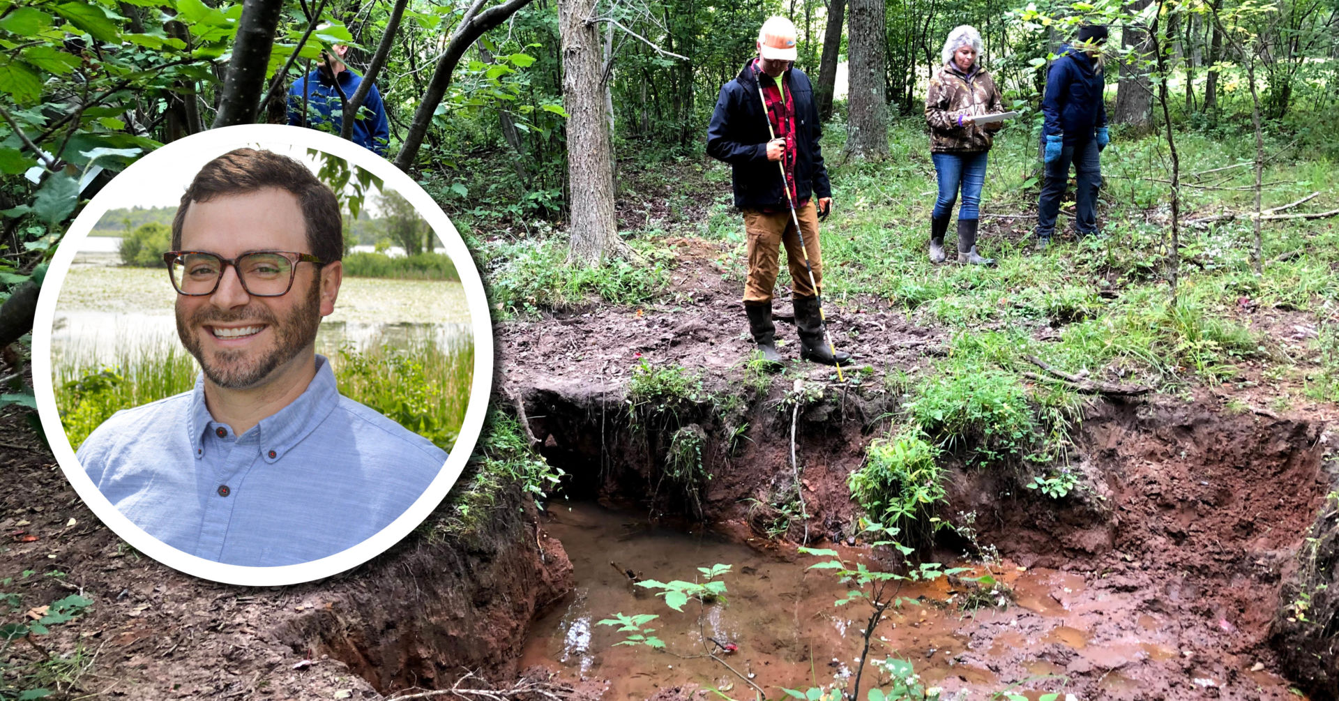
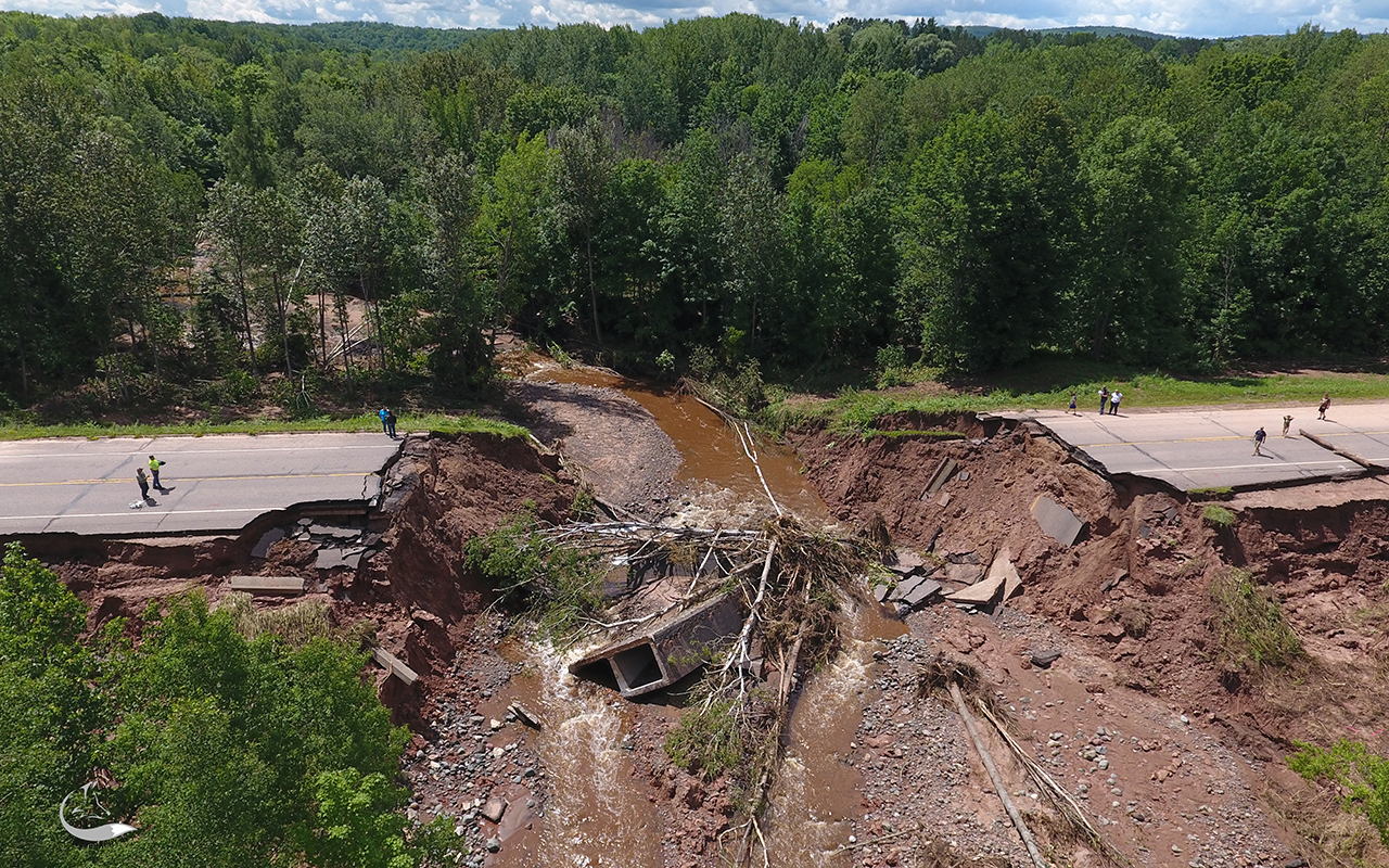
Within the last decade, residents of the Marengo Watershed have been impacted by a number of flood events that have resulted in both erosion and increased sedimentation on the land, damaging farmland and existing infrastructure such as culverts and roads. Most notable was a 500-year flood event in July 2016 that drastically altered the Marengo Watershed forever. During this event, extreme rainfall of 8 to 10 inches within an 8-hour period caused severe flooding that washed out culverts and shut down U.S. Highway 2, which is a major transportation route along the south shore of Lake Superior. Many people were trapped in their homes for weeks with little or no access to clean water and electricity. Beyond that, the landscape changed with rapid river widening due to severe erosion, eliminating brook trout habitat and uprooting forests. This 2016 event, among several other recent flood events from 2012 and 2018 in the area, were the main impetus for this project and highlighted the need for a more robust and environmentally focused Marengo Watershed restoration strategy that incorporates improved hydrologic and hydraulic (H&H) modeling, functional assessment of wetlands and infrastructure, and stakeholder engagement.
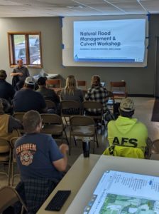
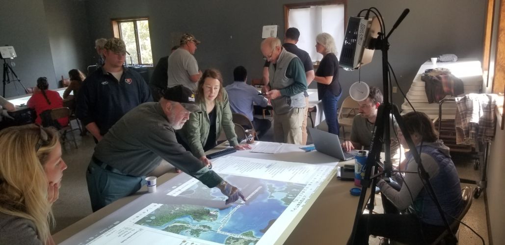
Marengo Watershed stakeholders gather at Morse Town Hall on Sept. 15 for the first of many Natural Flood Management & Culvert Workshops.
This workshop was the first of a series of workshops with stakeholders in an effort to create a watershed-wide strategy that prioritizes wetland and floodplain restoration to mitigate flood losses. Wetlands and floodplains are critical parts of a watershed’s ecosystem, serving as filtration and storage systems for flood water when waterways do not have the capacity. Preserving and restoring the natural and beneficial functions of wetlands and floodplains is a cost-effective means to preserve the health of a watershed and prevent future flood damage.
Using the CHARM participatory mapping tool, workshop participants gathered around tables to interact with local infrastructure data, erosion hazards, and newly developed flood maps. The workshop provided a space for stakeholders to share their experiences of the disastrous 2016 flood event that left a scar on the community’s infrastructure and mental health, costing lives and $35 million in damage. Through facilitated small-group discussions, stakeholders provided local knowledge to help verify existing data and highlight gaps in data that are needed for further analysis and to build scenario-based solutions for a follow-up workshop.
The project team will use stakeholder input and feedback received during this workshop to help update H&H models and scenarios, which will be used in future workshops for stakeholder-engagement exercises. Future workshops will continue to use CHARM participatory mapping tools to focus more on the feasibility and benefits/costs of different flood mitigation strategies for the Marengo Watershed. For more information about these workshops and this project, please visit our project website at no.floods.org/marengo.
This free workshop was funded by NOAA through the Great Lakes Restoration Initiative and FEMA.
The workshop was planned and hosted by:

Related content
Finding the right projects and practices to implement watershed-based hydrologic restoration
Wetland Coffee Break: Piloting natural flood management in the Lake Superior basin
![IMG_2376_for-blog-980x467[1]](https://www.wisconsinwetlands.org/wp-content/uploads/2022/11/IMG_2376_for-blog-980x4671-1.jpg)
