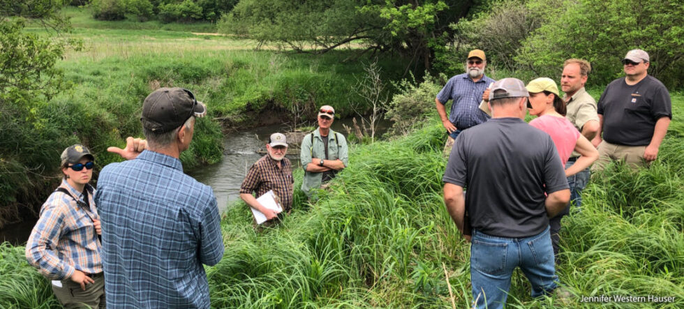
The examples included below highlight just some of the ways that healthy, biodiverse wetlands help our landscapes manage water.
Headwater wetlands
Wetlands located at the top of watershed are often the first line of defense against floodwaters—slowing and capturing water before it goes barreling downstream.
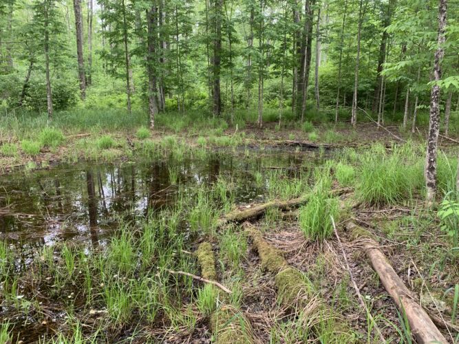
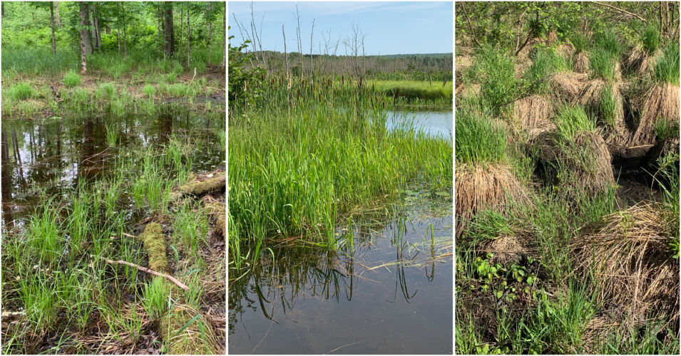
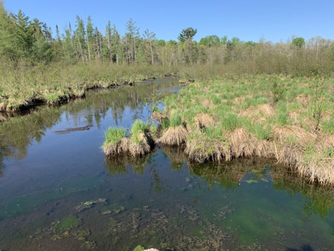
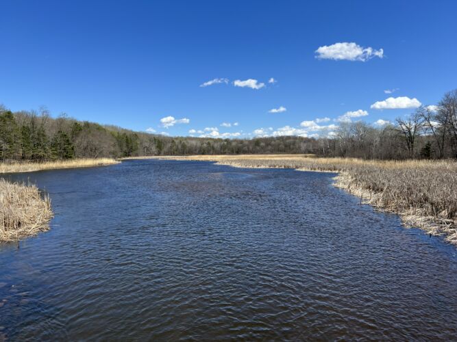
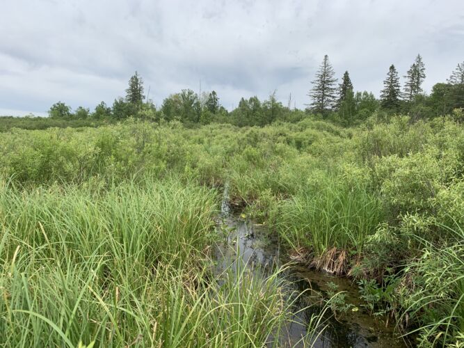
This large headwater grass/sedge wetland located in the Hay Meadow Creek watershed of Central Wisconsin is contributing to high groundwater levels that help maintain creek base flow in the hot summer months. Biodiversity is maintained on site, and healthy water conditions are supported downstream.
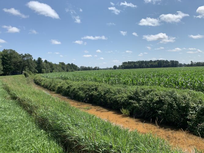
Here is an example of an unhealthy and poorly functioning wetland. Water in this cropped wetland in the upper watershed of Hay Meadow Creek is removed by an artificial ditch system that drains the Hay Meadow Creek watershed into an adjacent watershed. Because it is moved out of the wetland, the water can’t recharge the groundwater to benefit Hay Meadow Creek and likely contributes to high flood flows in the adjacent watershed during rain events. Contrast this photo with the healthy Hay Meadow Creek wetland above.
Floodplains
Farther downstream from headwater wetlands, floodplains are aptly named for their ability to capture and disperse floodwaters.
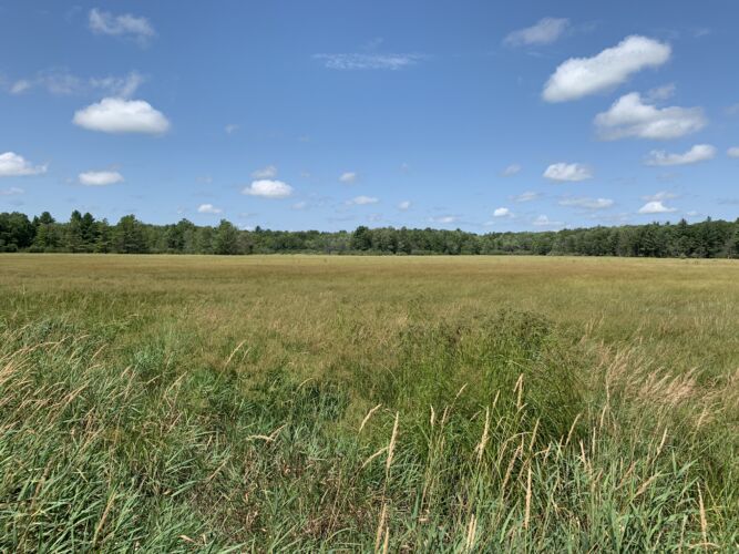
Healthy floodplains are flat (if maybe a little bumpy!) and give floodwaters space to spread out. The tussocks sedge meadow floodplain pictured here near Hayward, Wisconsin, helps keep this trout stream vibrant. This photo was taken during a very dry period, making it easier to see the ability of the tussocks to provide friction during high water, dissipating the energy associated with flood flows.
Here’s a close up of the beautiful tussocks from the photo above. Water that flows through these tussocks is split into hundreds of pathways, and the fine stem and roots of the sedges filter nutrients and capture sediment and debris associated with flood flows.

On the Yellow River in Burnett County, Wisconsin, hybrid cattail communities are swiftly displacing healthy tussocks sedge meadow floodplain habitats. In the right side of the photo, the dark vegetation is dense cattail growth on the river side of the floodplain. A healthy sedge meadow floodplain plant community is the light-colored vegetation behind the cattail stands. The invasive cattails grow so thick that they prevent flood flows from interacting with the river’s floodplain during all but very large floods. Contrast this photo with the Hayward trout stream photo above showing a healthy sedge meadow floodplain.
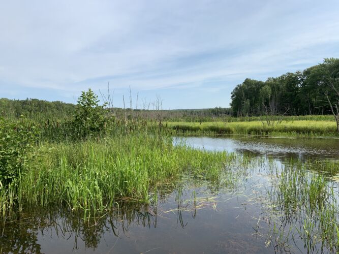
These riparian (riverside) wetlands protect the banks of the Raspberry River on the Red Cliff Reservation in Bayfield County, Wisconsin. These diverse native wetlands reduce the energy of wind and wave action while also receiving flood water and providing excellent fish and wildlife habitat. Healthy floodplain wetlands like this also provide the stable water conditions needed for wild rice production.
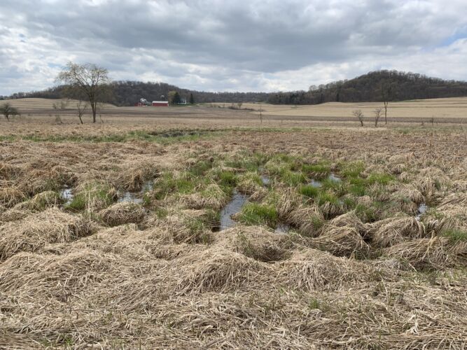
Healthy floodplains are flat. The one pictured here before spring green-up in Lower Fancy Creek, Richland County, Wisconsin, contains a broad, flat grass/sedge meadow. A maze of small distributary channels spread the flows out over a large area. A mosaic of wetland and upland habitats further slow and clean floodwaters. Even during non-flood times, groundwater enters the meadow from the surrounding hills, creating hydrologic conditions necessary to maintain the health of these vast sedge meadow wetlands even during the driest summers.
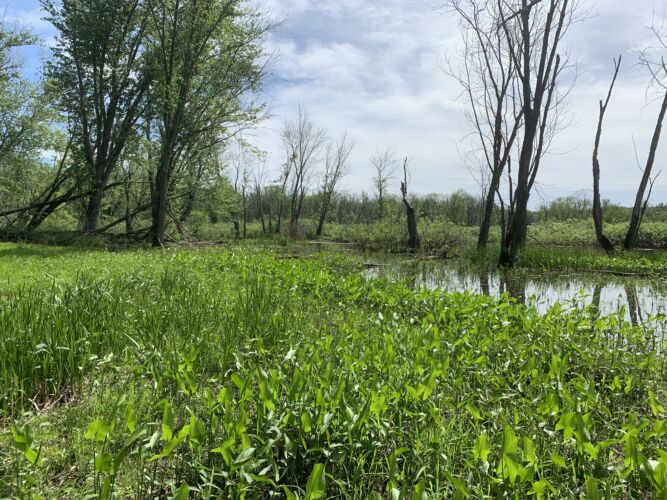
Healthy floodplains are messy and diverse. This photo, taken in the Lower Wisconsin River floodplain near Boydtown, Wisconsin (Crawford County), shows abundant downed wood and at least five different wetland types: emergent marsh, deep water slough, floodplain forest, grass/sedge meadow, and buttonbush shrub-carr. The diversity of plants and animals in this floodplain is unmatched in the region. During the spring, this area is inundated by several feet of floodwater. In the hot summer months, upwelling groundwater into the wetlands provide refugia for fish and wildlife.
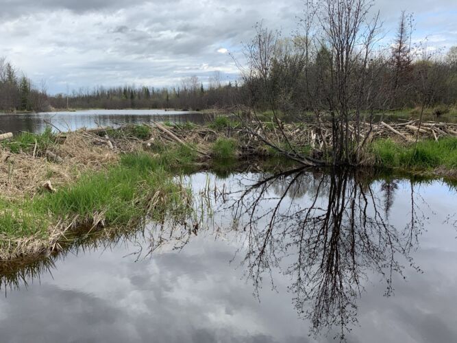
For thousands of years, beaver activity has been maintaining the health of our waterways. This photo is of the headwaters of North Pikes Creek in Bayfield County, Wisconsin. The dams on this creek attenuate flood flows, help recharge groundwater, and enhance baseflow conditions downstream. In this part of Wisconsin, nearly every beaver pond wetland complex contains breeding trumpeter swans and a diverse array of other wildlife.
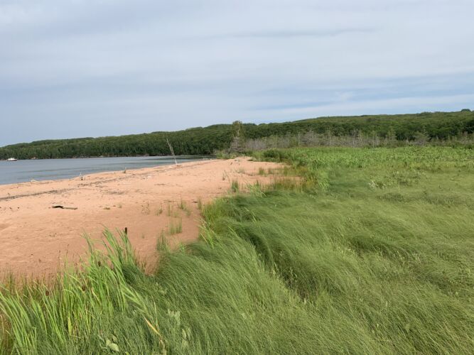
Large wetlands along the Lake Superior shoreline on the Red Cliff Reservation protect from wind and wave action while also providing plants for meeting the traditional and cultural needs of the Tribal community.
Keep your eye out for scenes like these the next time you’re out and about in your favorite wetlands. And give thanks to wetlands for not only providing abundant habitat and biodiversity but also helping protect our communities during times of heavy runoff.
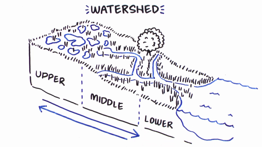
Learn more about how wetlands at different parts of the watershed help landscapes manage water.